
San Luis Valley: 884,000 Acre-Feet of Rain Drives New Flood Warning
A second atmospheric river brings 1 to 3 inches of precipitation to saturated soils, with Lake Powell storage rising nearly 7 feet after the initial surge.
By Olivia Reed ·
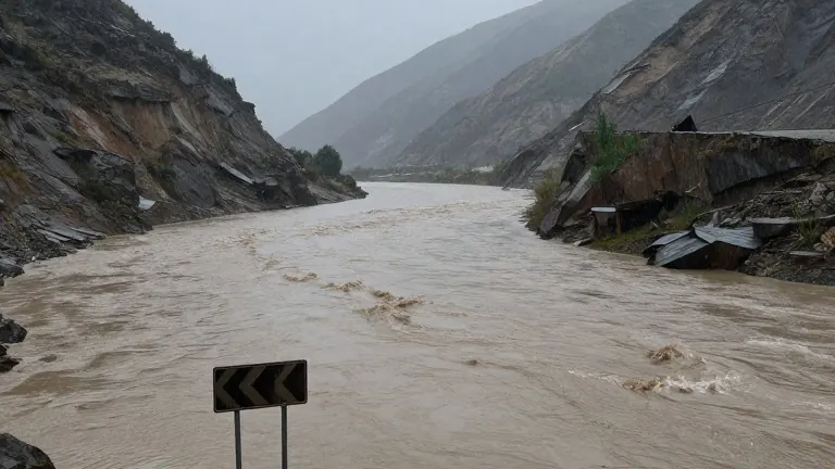
Mineral, Hinsdale, and Archuleta counties received 884,000 acre-feet of rain between Oct. 22 and Oct. 26, a volume that exceeds the annual urban water usage of the entire state. This extreme precipitation, which triggered a 1,000-year storm event in parts of the San Luis Valley, has left the region vulnerable to a second round of flooding. The National Weather Service (NWS) forecast indicates that another atmospheric river will bring 1 to 3 inches of precipitation to southern Colorado this weekend, with heavier amounts expected at higher elevations.
The incoming moisture is not expected to match the record-breaking levels of the previous week, but the saturated ground increases the risk of flash flooding. Brooke Scholtens, a meteorologist for the NWS Grand Junction region, noted that a pocket of low atmospheric pressure is combining with the atmospheric river to produce rain and snow. She stated that while the flooding may not be as widespread as the previous event, the risk remains high. "Right now, it doesn't look as if the flooding is going to be as widespread as the last event," Scholtens said.
River levels are expected to rise above critical thresholds. The San Juan River, which suffered severe flooding in Pagosa Springs, has an action stage of 9.48 feet. NWS projections indicate the river will reach 9.51 feet on Monday morning, though this figure may change. Communities along the Rio Grande, including Del Norte and Monte Vista, may also see high flows early next week, particularly along the Conejos River and the South Fork of the Rio Grande. Eric Petersen, a NWS meteorologist in Pueblo, advised residents in these areas to monitor weather conditions closely.
Snow is forecast to fall at elevations as low as 8,000 feet from Sunday into Monday. This could impact mountain passes, including Wolf Creek Pass, which was temporarily closed due to flood damage. Petersen estimated that the Wolf Creek ski area could receive up to a foot of snow. The weather pattern is influenced by a "super" El Nino, a condition characterized by unusually warm Pacific Ocean waters. Russ Schumacher, state climatologist with the Colorado Climate Center, explained that this phenomenon typically brings wet autumn conditions to southern Colorado. He clarified that a 100-year storm statistic indicates a 1% annual probability of occurrence, not a century-long interval between events.
The initial storm, which began Oct. 21, damaged 540 homes in Archuleta County alone, with the total number expected to rise. The event caused falling rocks, washed-out roads, and flooding across 12 counties in southern Colorado and the Four Corners region. The water surge also affected reservoirs upstream. Lake Powell, located on the Utah-Arizona border, saw its water elevation rise nearly 7 feet between Oct. 21 and Oct. 26. Its storage increased by 397,600 acre-feet, providing a temporary boost to the reservoir, which is currently less than 25% full. The Bureau of Reclamation reported that 266,000 acre-feet of water flowed into Navajo Reservoir during the same period.
Travelers are urged to avoid crossing flooded roadways, as 8 to 10 inches of water can float an average-sized car. Scholtens noted that most flood deaths occur in vehicles, making visibility and depth difficult to assess. The new storm could delay recovery efforts in areas already damaged by the previous week's flooding. Schumacher stated that the risk of additional flooding is present and may hamper road repairs and other restoration work. NWS forecasts remain uncertain regarding the specific elevations for rain versus snow and the likelihood of thunderstorms as of Thursday afternoon.
Source: The Colorado Sun